Aereovistas Geospatial Solutions

Aereovistas Geospatial SolutionsAereovistas Geospatial SolutionsAereovistas Geospatial Solutions

213-235-6413 / 605-277-0858

  • About us
  • Our Company
    • Our Vision
    • Meet our team
    • Locations
    • Careers
  • Services
    • Mapping services
    • Geospatial Analysis
    • Consulting Services
    • Drone rentals
    • Drone photography
    • Commercial real estate
    • Residential Real estate
    • Inspection
    • Agriculture
    • Small business
    • Thermal infrared Imaging
  • Contact us
  • More
    • About us
    • Our Company
      • Our Vision
      • Meet our team
      • Locations
      • Careers
    • Services
      • Mapping services
      • Geospatial Analysis
      • Consulting Services
      • Drone rentals
      • Drone photography
      • Commercial real estate
      • Residential Real estate
      • Inspection
      • Agriculture
      • Small business
      • Thermal infrared Imaging
    • Contact us

213-235-6413 / 605-277-0858

Aereovistas Geospatial Solutions

Aereovistas Geospatial SolutionsAereovistas Geospatial SolutionsAereovistas Geospatial Solutions
  • About us
  • Our Company
    • Our Vision
    • Meet our team
    • Locations
    • Careers
  • Services
    • Mapping services
    • Geospatial Analysis
    • Consulting Services
    • Drone rentals
    • Drone photography
    • Commercial real estate
    • Residential Real estate
    • Inspection
    • Agriculture
    • Small business
    • Thermal infrared Imaging
  • Contact us

Trusted geospatial Solutions

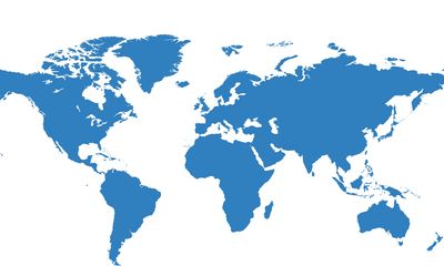
Continental United States (CONUS) and international operations

Our geospatial-focused service and commitment to staying current with industry advancements enable us to provide innovative and sustainable solutions. 

Aereovistas extends its services within the Continental United States (CONUS) and internationally (OCONUS), demonstrating our comprehensive expertise in coordinating and managing enterprise-level geospatial programs across diverse geographical regions.

Aereovistas' extensive experience in CONUS and OCONUS operations further solidifies our capability to manage and coordinate enterprise geospatial programs, ensuring stakeholders receive accurate and relevant geospatial data to support their strategic objectives. 

Our locations

Our History

Our Approach

Our Approach

Established in 1998, Aereovistas Geospatial Solutions has been providing top-notch surveying services to clients across the country. Our experienced team of surveyors uses the latest technology to ensure accurate results.

Our Approach

Our Approach

Our Approach

At Aereovistas Geospatial Solutions, we take a client-focused approach to our work. We work closely with our clients to understand their needs and provide personalized solutions. Our goal is to exceed our clients' expectations on every project.

Our Services

Our Approach

Our Services

We offer a wide range of surveying services, including boundary surveys, topographic surveys, and construction staking. Our team has the expertise to handle projects of any size and complexity.

Aereovistas Geospatial Solutions

605-277-0858 / 213-235-6413 / mbuhjoe@yahoo.com

Copyright © 2024 Aereovistas Geospatial Solutions - All Rights Reserved.

Powered by Aereovistas

This website uses cookies.

We use cookies to analyze website traffic and optimize your website experience. By accepting our use of cookies, your data will be aggregated with all other user data.

Accept